
Tidal Resources
On all the maps I publish I include tidal diamonds, and tidal gate information if I am aware of it. I also include data on secondary ports and their tide heights and times relative to the local tidal port.
Scotland
Wales
England
Ireland
France
Norway
Crossing Corrector
Scotland
Outer Hebrides
Orkney
Shetland
Pentland Firth
North West North Sea
West Coast
South West Coast
Outer Hebrides
Outer Hebrides
Orkney
Orkney Tides
Shetland
Pentland Firth
Pentland Firth
North West North Sea
West Coast
West Coast of Scotland
South West Coast
SW Scotland
Wales
Anglesey
Anglesey
England
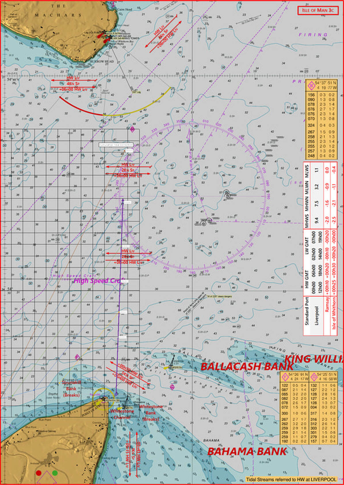
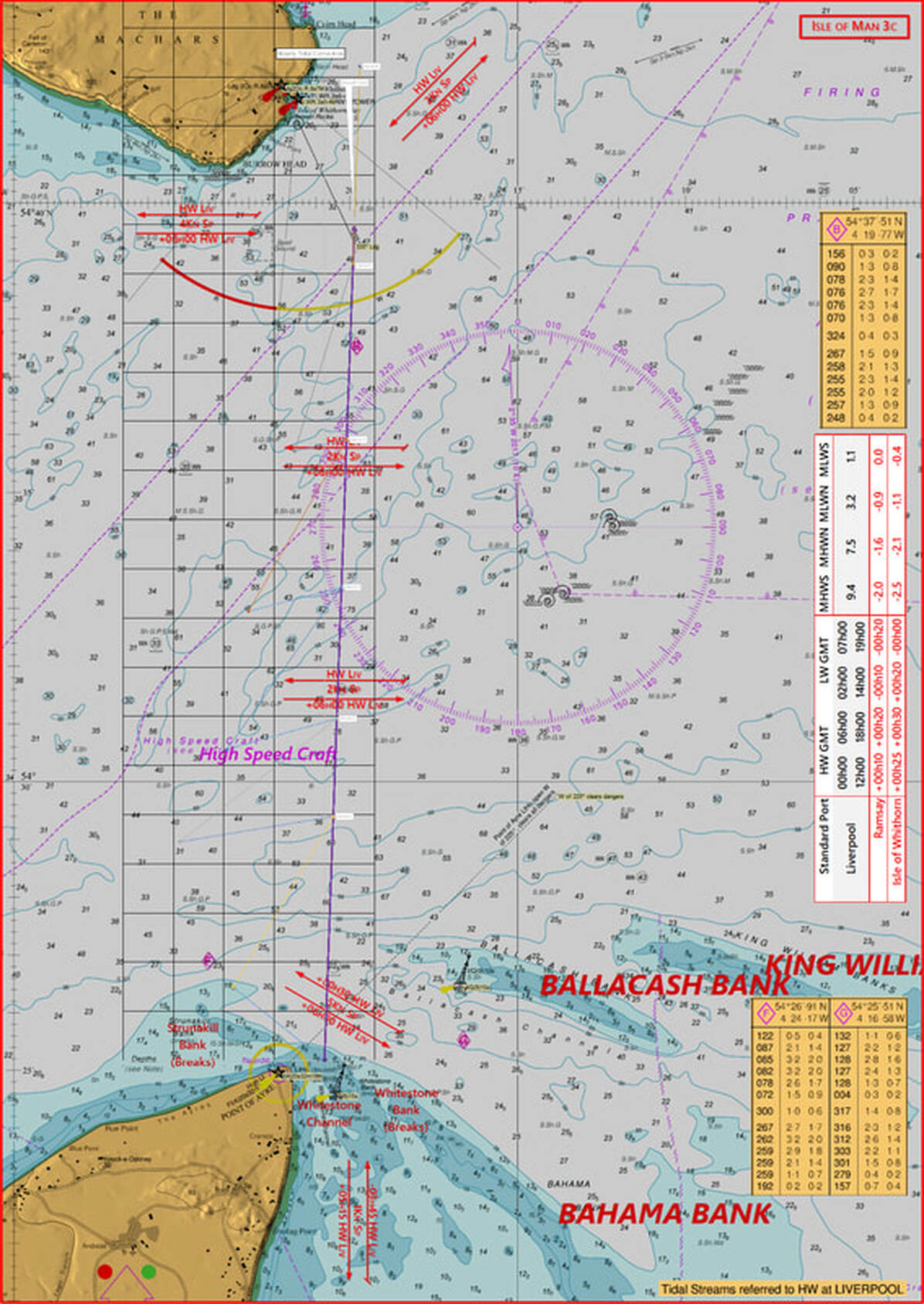
East Irish Sea
East Irish Sea
Ireland
France
Norway
Crossing Corrector
I remember a few years back preparing for my Advanced Sea Leader assessment (back then it was 5 star!), and considering what they might request for a major crossing plan with tidal correction. I wasn't too daunted by the exercise technically, even if they asked for late changes to the plan - (e.g. whoops you're delayed by two hours etc...) - being an engineer & having got my coastal skipper award eons before I was pretty au-fait with vector calculations - but what surprised me was that there didn't appear to be any tools or apps readily available to automate the task, even for Yachties.
So I set about roughing something out using Excel - and in the process encountered some of the complexities, challenges & limitations in making a reliable general purpose tool!
I incorporated:
So I set about roughing something out using Excel - and in the process encountered some of the complexities, challenges & limitations in making a reliable general purpose tool!
I incorporated:
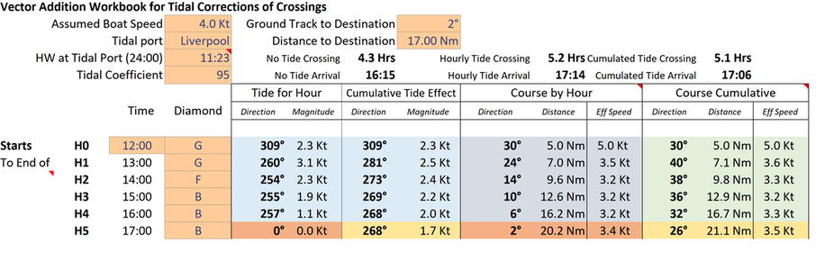
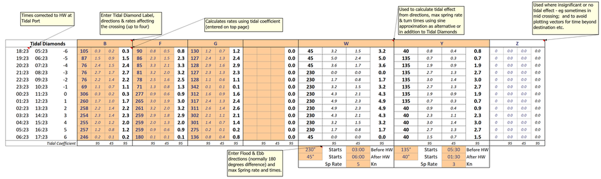
- Ability to input multiple tidal diamonds, general tidal gate or stream info and an easy method of choosing when these would interact with your passage
- Input tidal coefficients and tidal port HW times
- Passage start time & assumed boat speed through the water
- Ground track distance and heading to destination
|
|
The spreadsheet calculates the specific tidal effect for each hour of the passage, using the tidal diamond you have chosen, and correcting for the hourly timing vs high water & the tidal coefficient. It then does the appropriate tidal vector addition & vector triangle solution to maintain the ground course - either cumulating the total tidal effect for the passage to the end of the specific hour, or doing a sequential correction hour by hour and allowing you to consider either.
There are challenges with finding the solution to each vector triangle automatically - there are either two solutions - one of which is in the wrong direction that needs to be ignored, or no solution when the boat speed can't compensate for the tidal stream to stay on the ground course - which then at least needs to be indicated!
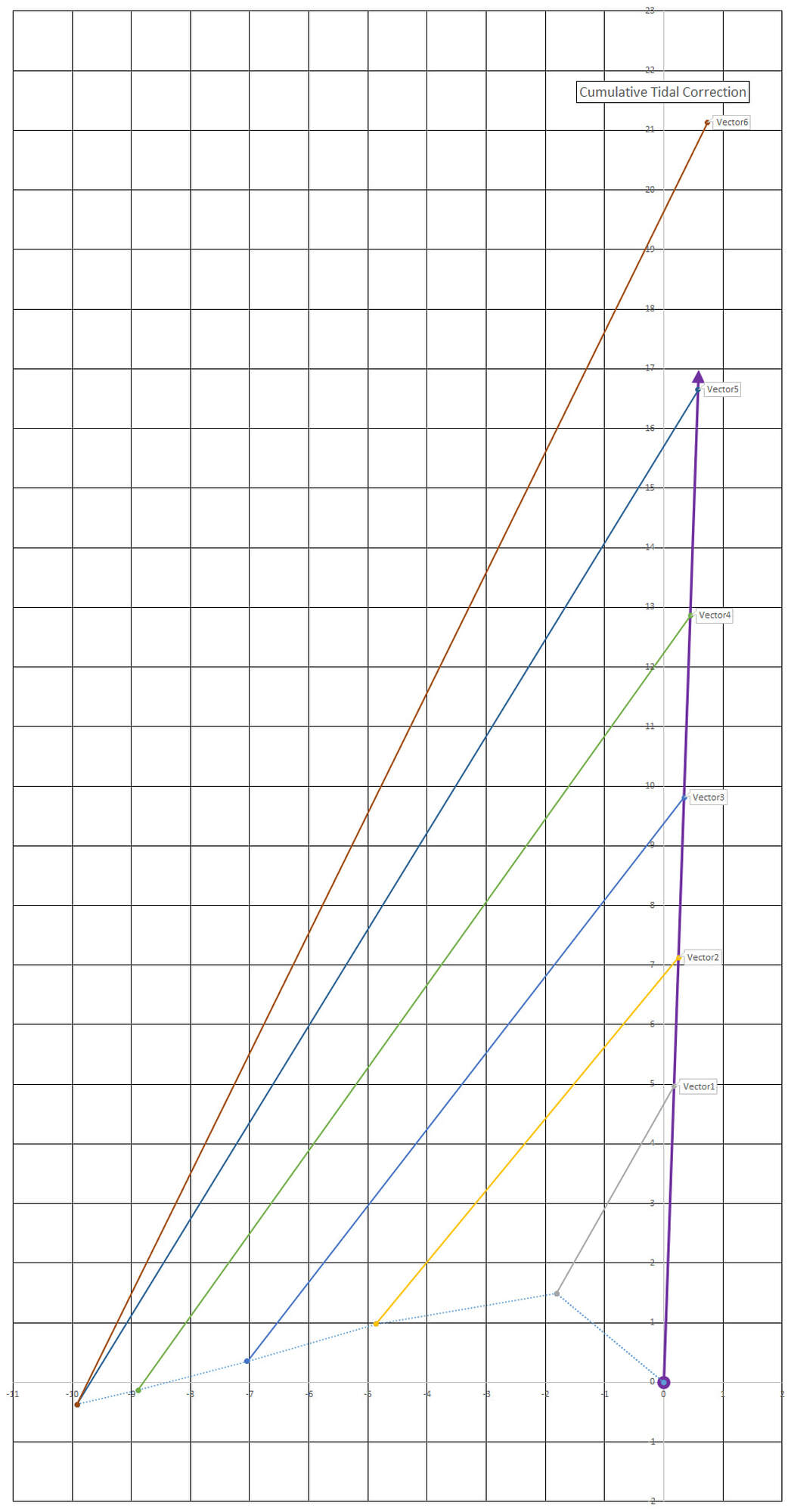
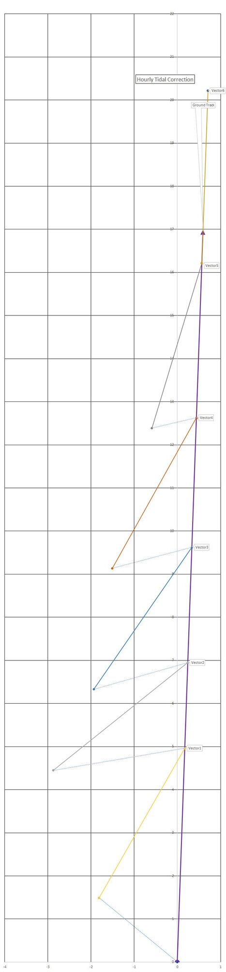
Below shows the graphical output that illustrates the cumulative, or hour by hour correction, and below that the output overlayed onto the relevant chart for the crossing (Note this last overlay is not done by the software - I copied the output graphics and overlaid it on top of an image from mapping software).
There are challenges with finding the solution to each vector triangle automatically - there are either two solutions - one of which is in the wrong direction that needs to be ignored, or no solution when the boat speed can't compensate for the tidal stream to stay on the ground course - which then at least needs to be indicated!
Below shows the graphical output that illustrates the cumulative, or hour by hour correction, and below that the output overlayed onto the relevant chart for the crossing (Note this last overlay is not done by the software - I copied the output graphics and overlaid it on top of an image from mapping software).
|
|
|
|
So it was an interesting challenge for a few hours programming - and maybe now I understand better why there isn't any automatic tool for this - unless someone knows better than me and can point me in the right direction.
Very happy to share the tool which you can download here - please let me know if you find any issues or have suggestions as to how to improve it!
If I was to consider a version 2 I would probably think about a couple of things:
Very happy to share the tool which you can download here - please let me know if you find any issues or have suggestions as to how to improve it!
If I was to consider a version 2 I would probably think about a couple of things:
- Generating the ground track and related tidal streams with coordinate data so that they can be used by a GPS or planning software and automatically superimposed on a map or chart etc
- Ability to automatically choose the right tidal diamonds/ tidal gate info based on position, and also to average or weight it if different streams act at different parts over each passage hour calculation, for example by using a smaller time interval for the detailed calculations....
- When ground track can't be maintained to provide option for a 'best alternative' with loss of position, rather than just saying it is impossible.
Events
|
News &
|
Client
|
Guide &
|
Useful
|

|
Vertical Divider
|
|
info@atlanticshoresseakayakguide.co.uk
|
+44 7768 010165
|
+44 18687 80050
|
|
|
Vertical Divider
|